

Explore Game of Thrones Map: Fan’s Guide to Westeros and Beyond
The Game of Thrones map is one of the most iconic fictional worlds in entertainment history. Whether you’re a die-hard fan of the HBO series, a devoted reader of George R.R. Martin’s books, or a player of the various games set in this universe, understanding the geography of Westeros, Essos, and the surrounding lands is essential to fully appreciating the story. This comprehensive guide will help you navigate the intricate details of the Game of Thrones map and discover what makes this world so captivating.
From the frozen wastes beyond the Wall to the sun-soaked deserts of Dorne, the Game of Thrones map showcases an incredibly detailed fantasy world that rivals any other in gaming and television. Each region has its own culture, politics, and strategic importance that directly impacts the ongoing struggle for the Iron Throne. Understanding these geographical nuances will enhance your appreciation of the series and help you grasp why certain battles occur where they do.
The Seven Kingdoms of Westeros
Westeros is the primary setting for most Game of Thrones action, comprising the Seven Kingdoms that constantly vie for control. The map of Westeros reveals a massive continent roughly the size of South America, divided into distinct regions, each with its own castle, culture, and ruling house. Understanding this political geography is crucial for anyone wanting to grasp the complex power dynamics that drive the narrative.
The North is the largest and most sparsely populated kingdom, ruled from Winterfell by House Stark. This cold, harsh region breeds warriors and teaches its people that winter is coming—a motto that defines the Northern philosophy. The North’s strategic importance lies in its vast lands and the loyalty of its people, though its distance from the capital often makes it feel isolated from the politics of the south.
The Vale of Arryn sits to the east, protected by the Mountains of the Moon. This defensible region, ruled from the Eyrie, has historically remained neutral in many conflicts due to its geographical isolation. The Vale’s mountain passes are difficult to traverse, making it nearly impossible to invade directly.
The Riverlands occupy the central portion of Westeros and are perhaps the most war-torn region on the Game of Thrones map. With numerous rivers and castles, this area serves as a buffer zone between the North and the south, making it a constant battleground during conflicts. The Riverlands lack a single strong ruler, which contributes to their vulnerability.
The Westerlands, ruled by House Lannister from Casterly Rock, are rich in gold and resources. This western region’s wealth makes it one of the most powerful kingdoms despite its smaller size. The Lannisters’ control of the Westerlands’ gold has been instrumental in their political influence across Westeros.
The Reach, the most fertile and populous region, is ruled from Highgarden by House Tyrell. This southern kingdom produces the most food and resources, making it economically vital to the realm. The Reach’s agricultural wealth translates directly to military power and political influence.
The Stormlands occupy the southeastern coast, ruled from Storm’s End. This region frequently experiences severe weather, hence its name. The Stormlands are strategically important due to their coastal position and proximity to King’s Landing.
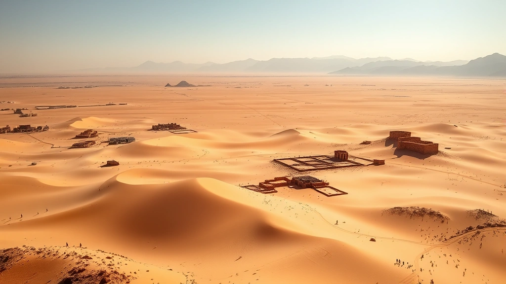
Finally, Dorne, the southernmost kingdom, stands apart from the others. Ruled from Sunspear, Dorne has a different culture, climate, and history than the rest of Westeros. The region’s deserts and mountains make it difficult to conquer, a lesson many invaders have learned through failure. If you’re interested in exploring similar complex fantasy worlds, check out our guide to best single player games 2025 that feature intricate worldbuilding.
The Crownlands surround King’s Landing and are directly controlled by the Iron Throne. This region is the political heart of Westeros and the seat of power for whoever controls the Seven Kingdoms.
Beyond the Wall: The Lands of Ice and Snow
North of the Wall lies territory that most people in Westeros consider to be the edge of civilization. The Game of Thrones map extends far beyond the Wall, revealing lands populated by wildlings, White Walkers, and countless mysteries. This frozen expanse represents both a physical barrier and a psychological one, separating the known world from the unknown.
The Wall itself is perhaps the most impressive structure on the Game of Thrones map—a 700-foot-tall barrier of ice stretching 300 miles across the continent. Built thousands of years ago to protect against threats from the north, the Wall has stood as a symbol of Westeros’s defense against both wildlings and the supernatural forces beyond.
Beyond the Wall, the landscape becomes increasingly harsh and inhospitable. The Lands of Always Winter represent the northernmost reaches, where temperatures drop to deadly levels and the very earth seems frozen. This region is home to White Walkers and other creatures that most people consider to be nothing more than legends. The mystery and danger of these lands drive much of the Game of Thrones narrative, particularly in later seasons.
The wildling territories, while not formally organized on most maps, represent a significant portion of the lands beyond the Wall. These scattered communities and tribes have their own cultures and survival strategies adapted to the brutal climate. Understanding the geography of these northern lands is essential to appreciating the threat they pose to Westeros.
Essos: The Vast Eastern Continent
Across the Narrow Sea lies Essos, a massive continent with its own diverse regions, cultures, and conflicts. The Game of Thrones map of Essos reveals a world nearly as complex as Westeros itself, with free cities, ancient ruins, and vast unexplored territories.
The Free Cities line the western coast of Essos and serve as major trading hubs and centers of power. Cities like Braavos, Pentos, and Volantis are ancient, wealthy, and politically significant. Braavos, in particular, is famous for its unique culture and the House of Black and White, a mysterious assassin organization.
The Dothraki Sea is a vast expanse of grasslands in central Essos, home to the nomadic Dothraki people. This region on the Game of Thrones map represents a completely different way of life—one based on horsemanship, conquest, and a warrior culture fundamentally different from the feudal systems of Westeros.
To the south lies Old Valyria, a once-great empire now reduced to ruins and dangerous lands. The Valyrian Peninsula is considered cursed and is largely uninhabitable, though its history profoundly influences the politics and magic of the entire world. The Targaryen family, who ruled Westeros for centuries, originated from Valyria.
The Red Wastes represent another harsh environment on the Essos portion of the Game of Thrones map. This desert region is sparsely populated and dangerous, serving as a barrier between the Dothraki Sea and southern Essos.
Further east, the map becomes less detailed and more mysterious. The Jade Sea and lands beyond represent the edge of known geography in the Game of Thrones world, similar to how ancient maps marked unknown territories as dangerous or unexplored.
Strategic Locations and Strongholds
The Game of Thrones map is dotted with hundreds of castles, cities, and strategic locations that serve as important plot points throughout the series. Understanding these locations helps readers and viewers grasp why certain battles occur and why control of specific territories matters so much.
King’s Landing is the capital and the ultimate prize in the struggle for the Iron Throne. Built on the Blackwater Rush, this city serves as the political center of Westeros. Control of King’s Landing means control of the realm, making it the most fought-over location on the Game of Thrones map.
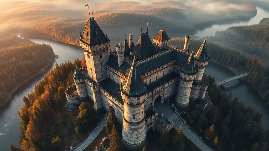
Winterfell, the ancestral seat of House Stark, is the largest castle in the North and serves as the primary setting for much of the series’ early action. Its strategic importance lies in its position as the gateway between the North and the south, making it a natural focal point for conflicts.
The Eyrie, perched high in the Mountains of the Moon, is nearly impregnable due to its geography. This castle’s isolation makes it one of the most defensible positions on the Game of Thrones map, though it also limits its influence over wider territories.
Casterly Rock, the Lannister stronghold, is built into a mountain and contains vast gold mines. This fortress’s wealth and strategic position make it one of the most important locations in Westeros.
Highgarden, the Tyrell seat, is renowned for its beauty and agricultural importance. This castle represents the wealth and power of the Reach, the most fertile region on the Game of Thrones map.
These strongholds are more than just physical locations—they’re centers of power and culture that define their respective regions. For gamers interested in exploring similar strategic depth, consider checking out our guide on best indie games for PC that feature complex world-building and strategic gameplay.
Interactive Maps and Gaming Resources
In the digital age, exploring the Game of Thrones map has become easier than ever. Multiple interactive online maps allow fans to zoom in on specific regions, read about locations, and trace character journeys. These tools have become invaluable resources for fans seeking deeper knowledge of the world.
Several fan-created interactive maps provide detailed information about every location mentioned in the books and show. You can hover over castles to learn their history, click on regions to read about their cultures, and follow character movements across the Game of Thrones map. IGN has published several excellent guides to the Game of Thrones geography that complement interactive maps perfectly.
Video game adaptations have also provided unique ways to explore the Game of Thrones map. Games like Game of Thrones: The Telltale Series allow players to walk through famous locations and experience the world from a first-person perspective. These games transform the static map into an interactive, explorable environment that brings Westeros to life in ways that reading or watching cannot replicate.
If you’re interested in games with similar narrative complexity and world exploration, our article on GameForge Daily Blog features extensive coverage of story-driven games that rival Game of Thrones in terms of worldbuilding depth.
Mobile applications have also emerged, offering offline access to detailed Game of Thrones maps. These apps often include character trackers, timeline features, and the ability to bookmark important locations for future reference.
How to Use the Map for Gaming
Whether you’re playing Game of Thrones video games or engaging in tabletop roleplaying, understanding the Game of Thrones map is crucial for immersive gameplay. Players should study the map before starting campaigns to understand supply lines, travel times, and strategic chokepoints.
When playing strategy-based Game of Thrones games, the map becomes your battlefield. Understanding which regions control resources, which areas are defensible, and which territories are economically valuable will directly impact your success. Many players spend hours studying the Game of Thrones map before committing to military strategies.
For roleplaying games set in this world, the map provides essential context for character backgrounds and campaign settings. A character from the Vale will have different cultural values than one from Dorne, and the map helps players understand these distinctions.
Consider printing out a detailed Game of Thrones map and keeping it nearby while playing or watching. This simple tool can significantly enhance your understanding of plot developments and strategic decisions. Many gaming groups do this during tabletop campaigns, using the map to track armies, plan movements, and resolve conflicts.
If you’re looking to improve your gaming setup, check out our gaming PC build guide for recommendations on systems that can handle complex strategy games set in expansive worlds like Westeros.
For those interested in creating content about Game of Thrones games, our guide on how to record gameplay on PC provides excellent tips for capturing your gaming experiences in high quality.
Pro Tips for Map Mastery: Create a personal legend noting which houses control which territories at different points in the timeline. Mark important battle sites and travel routes. Use color-coding to track political allegiances. This preparation will dramatically enhance your gaming experience and your understanding of the complex politics driving the narrative.
The Game of Thrones map is far more than a simple geographical reference—it’s a character in itself, shaping every decision, battle, and political maneuver throughout the series. Whether you’re a casual fan or a dedicated gaming enthusiast, taking time to truly explore and understand this world will deepen your appreciation for the intricate storytelling that makes Game of Thrones such a compelling universe.
FAQ
What is the largest kingdom on the Game of Thrones map?
The North is the largest kingdom on the Game of Thrones map, comprising roughly one-third of Westeros’s total landmass. However, it’s also the most sparsely populated due to its harsh climate and cold weather.
How accurate are the interactive Game of Thrones maps?
Most fan-created and official interactive maps are extremely accurate to the source material. However, some details vary depending on whether they’re based on the books or the television series, as George R.R. Martin has provided more detailed geographical information in his novels than what appeared on screen.
Can I use Game of Thrones maps for tabletop gaming?
Absolutely! Many tabletop gaming groups use printed Game of Thrones maps as the foundation for campaigns. The map provides excellent scale references and strategic depth that enhances gameplay significantly.
What regions on the Game of Thrones map are most important strategically?
King’s Landing, the Riverlands, and the Narrow Sea crossing points are the most strategically important locations. Control of these areas often determines who can dominate Westeros politically and militarily.
Are there games where I can explore the Game of Thrones map directly?
Yes, several games allow exploration of the Game of Thrones map, including the Telltale series, Crusader Kings mods, and various strategy games. These provide interactive ways to experience the world beyond static maps.
How does the Game of Thrones map compare to other fantasy worlds?
The Game of Thrones map is remarkably detailed and geographically logical, rivaling maps from franchises like Lord of the Rings and The Witcher. Its size and complexity make it one of the most impressive fantasy maps ever created.
Where can I find official Game of Thrones maps?
GameSpot and official HBO resources provide high-quality official maps. George R.R. Martin’s official website also contains authoritative geographical information about Westeros and Essos.

